
With the Mountain Day Twistybutt just over a month away and route possibilities still swimming around in my melon, it was time to check off two gnarly passes that traverse the ridges separating Yamanashi and Shizuoka.
A quick peruse online showed them open and as the Mountain Day Twistybutt may become a two day event this year, one of these passes could be stuffed into the first day route for more road n twisties. But would they be too much or even open…?
The map below shows the two contenders: Yanbushi Touge above, and Abe Touge below it. Abe is the shorter and more conventional of the two, and I’d recommend everyone give it a go if they have the chance. The views are great—especially the direct gawk at Fuji’s crack on its western flank. And it’s a neat shortcut… when it’s open.
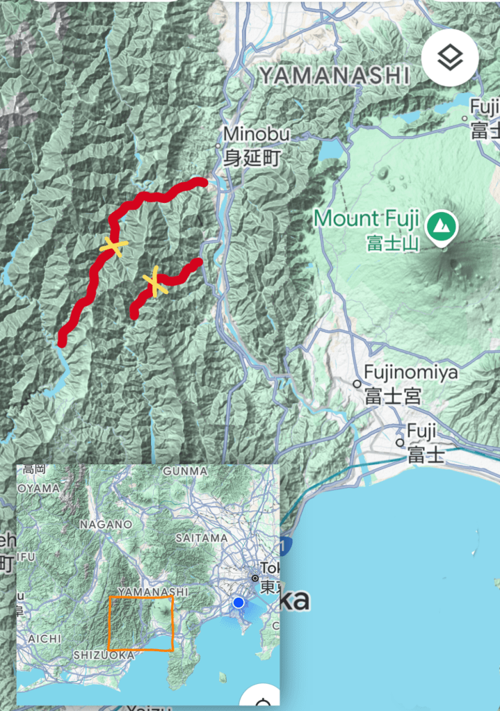
Yanbushi Touge is in another and unnervingly gnarly league. It has everything from sections of dirt and stone, “sayonara world” cliffside drops, picturesque yet dastardly lack of guardrails, tyre slicing slate shards, boulders, tunnels of spoon hewn doom n gloom, sporadic moss, spiderwebs that could possibly catch n cocoon a cliff diving rider… and then there’s just it’s pace and length and tortuous demands on concentration.
It’s about 50km up n over and I should have written this before setting out really. 😆 Let’s hit the road!
Getting off the Tomei at Susono, the MighTy10 and I rolled up the deer incident road, paid our respects then meandered our way over and through Kitayama to Nambu and swung north for the shuffle up Fujikawa Kaido.
Seeing a sign for a circuit through an abandoned tourist trap peaked the spidey senses so turned off to explore. It lead up to a tiny gymkhana and drift course deep in the valley.
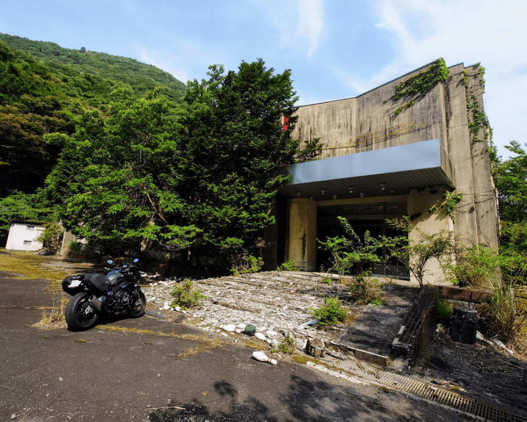
On the way back down, bowling pins caught my eye. They were strewn all over the front steps along with various other out of place stuff.
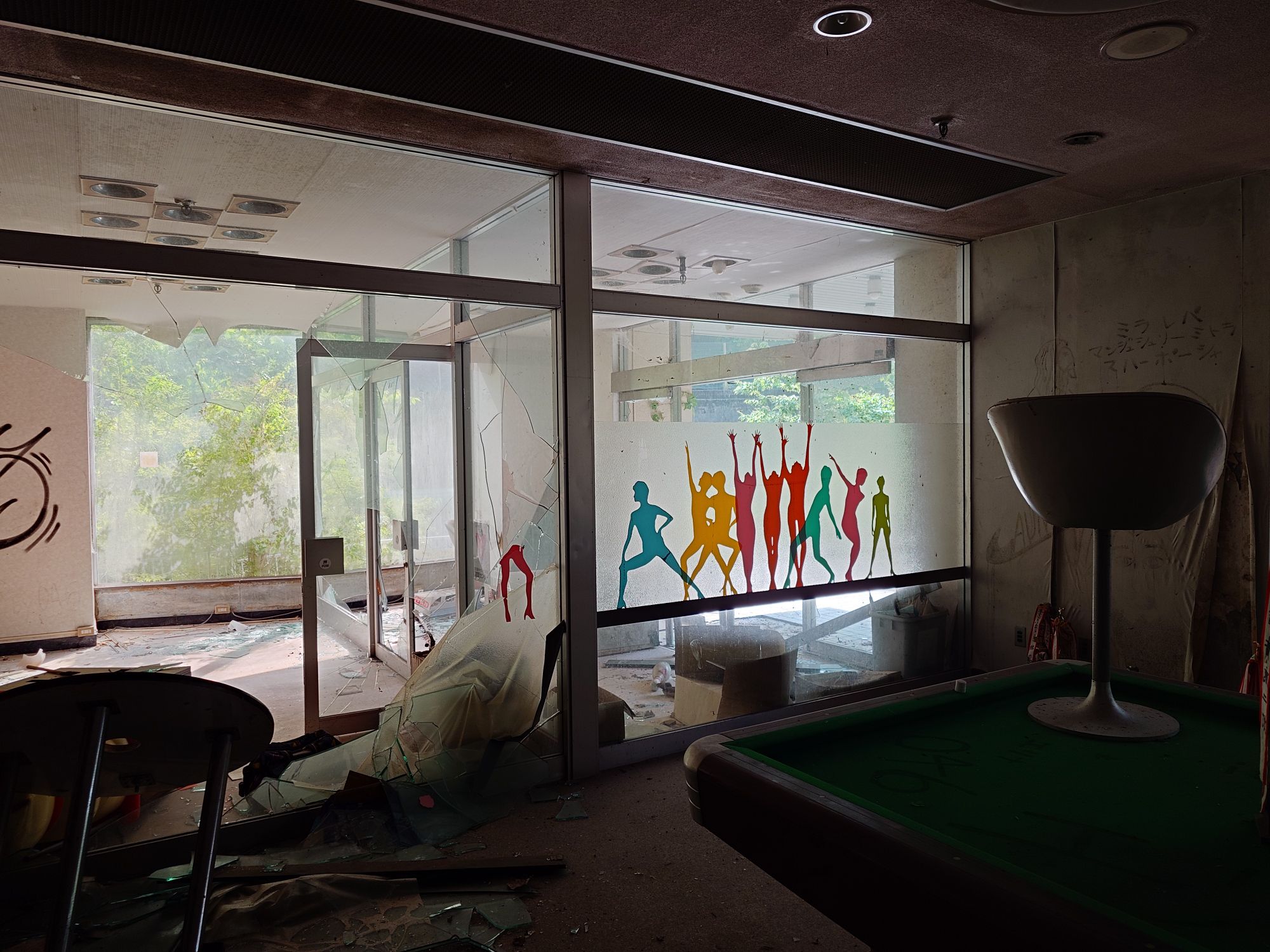
Inside was still remarkably furnished and accessorised. Vandalised and with a whiff of mould, too.

Huge! Counted 20 lanes.
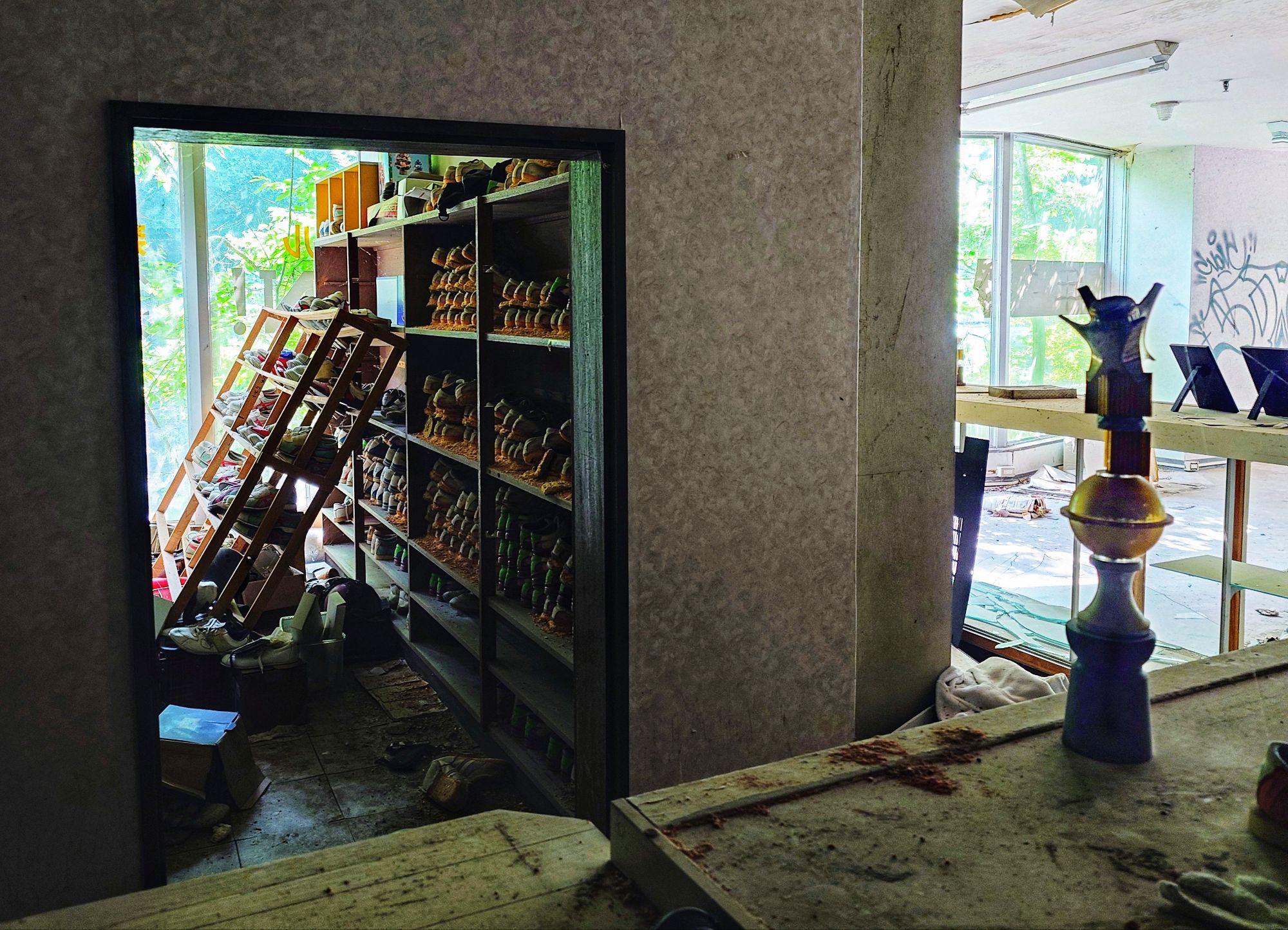
Squillions of bowling shoes still in the racks. Trophies too.
Everyone had just walked out and at that realisation, I did too.
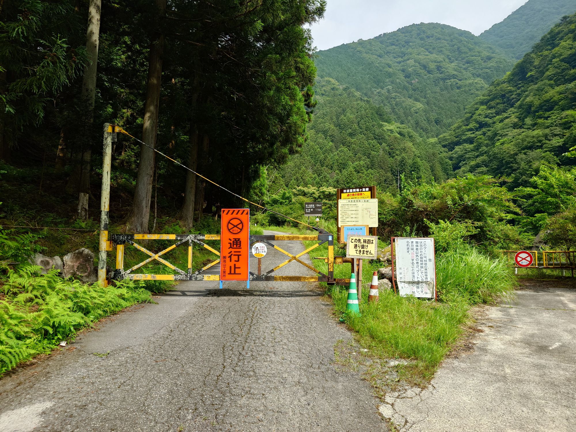
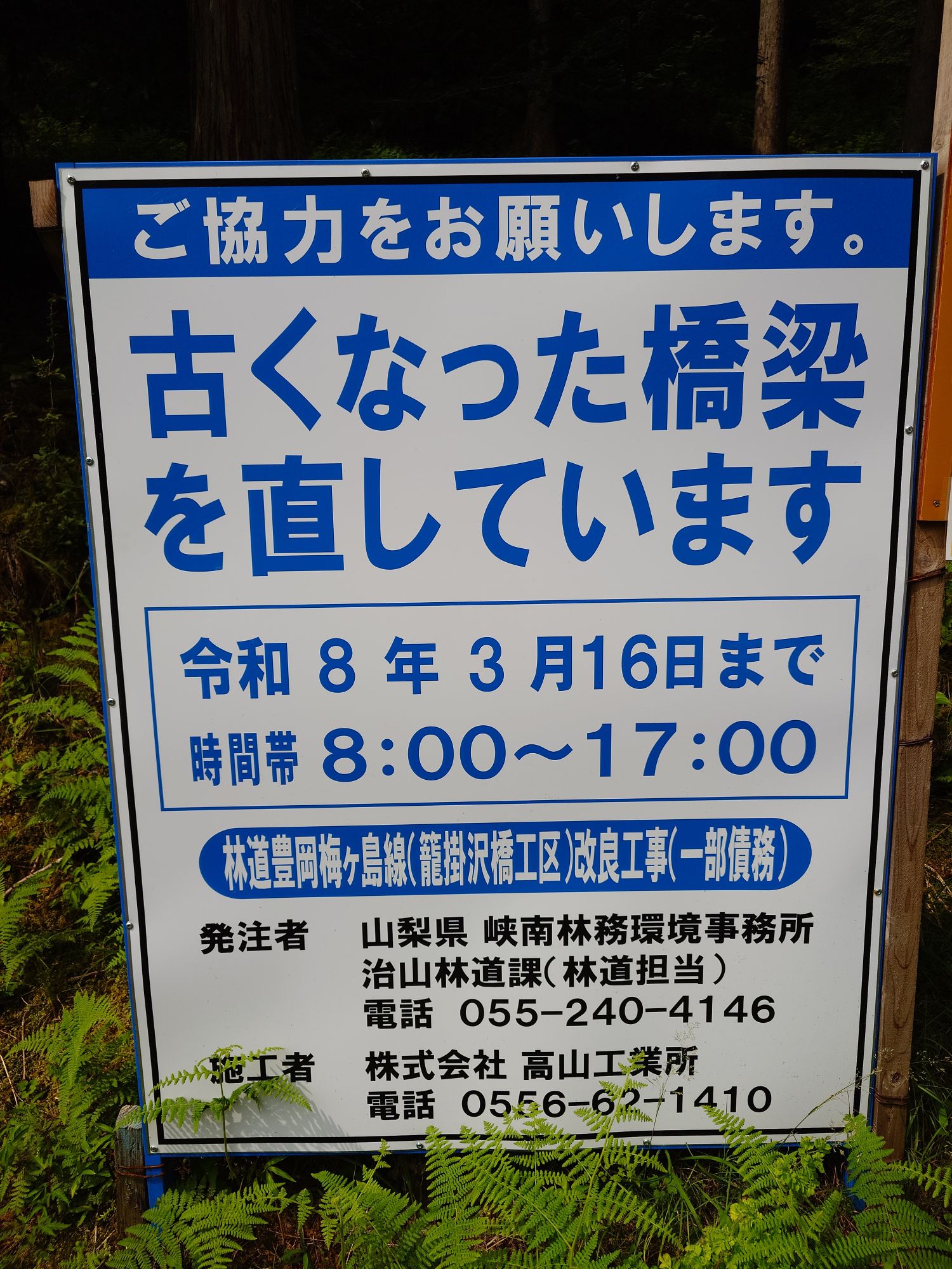
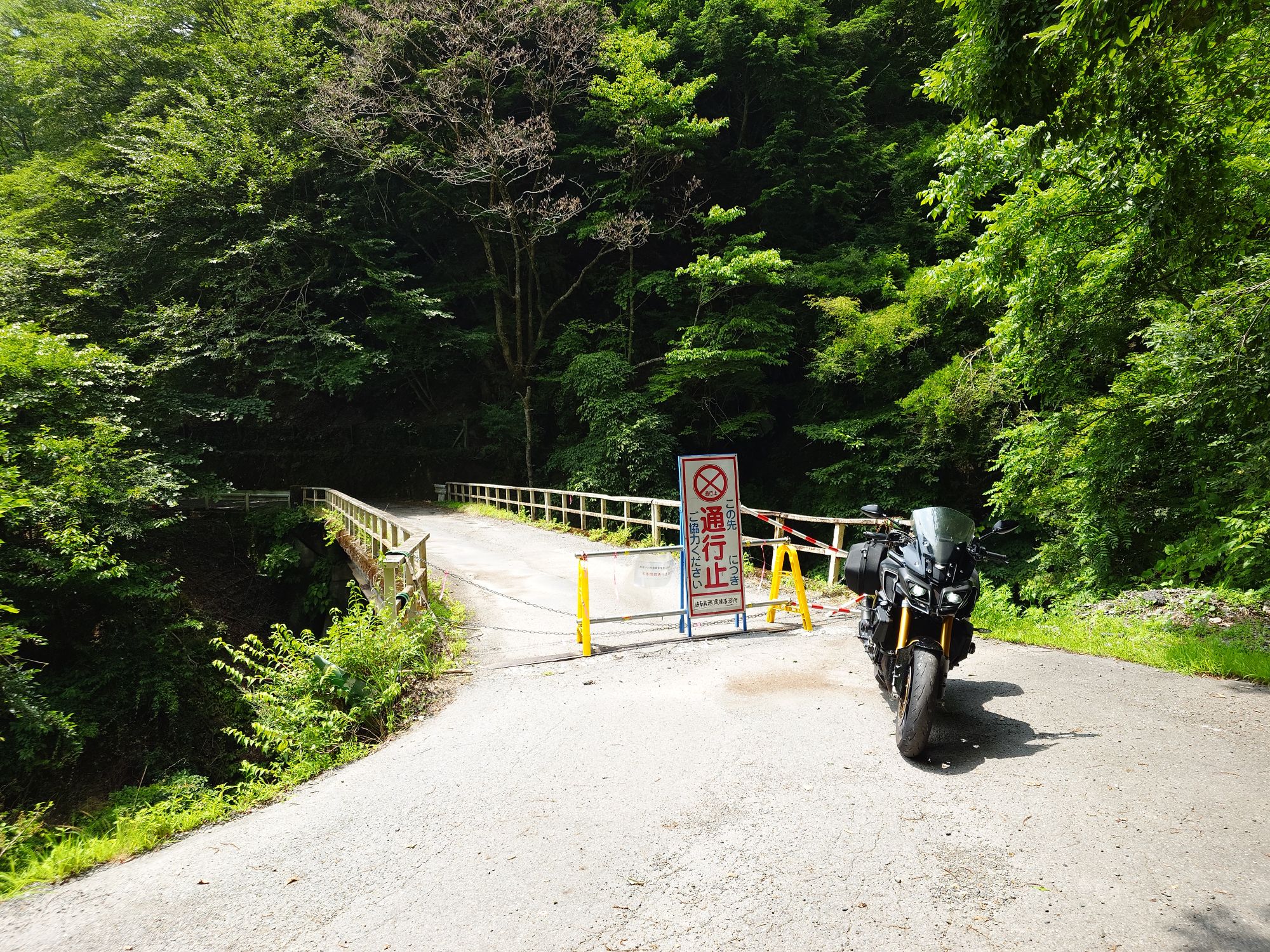
Bridge reconstruction until March. It’s always one thing or another with this road. I’ve been there more than a couple dozen times and got across less than ten.
Well, that’s one road scratched. I was really hoping this one was open and nice so I didn’t have to face the possibility of a crapified Yanbushi Touge mystery tour…
Turning onto the Amehata Oshima Sen which leads deep into the breach of the Yamanashi side of the Minami Alps towards Yanbushi Touge, I had some other stuff I wanted to enjoy on the way.
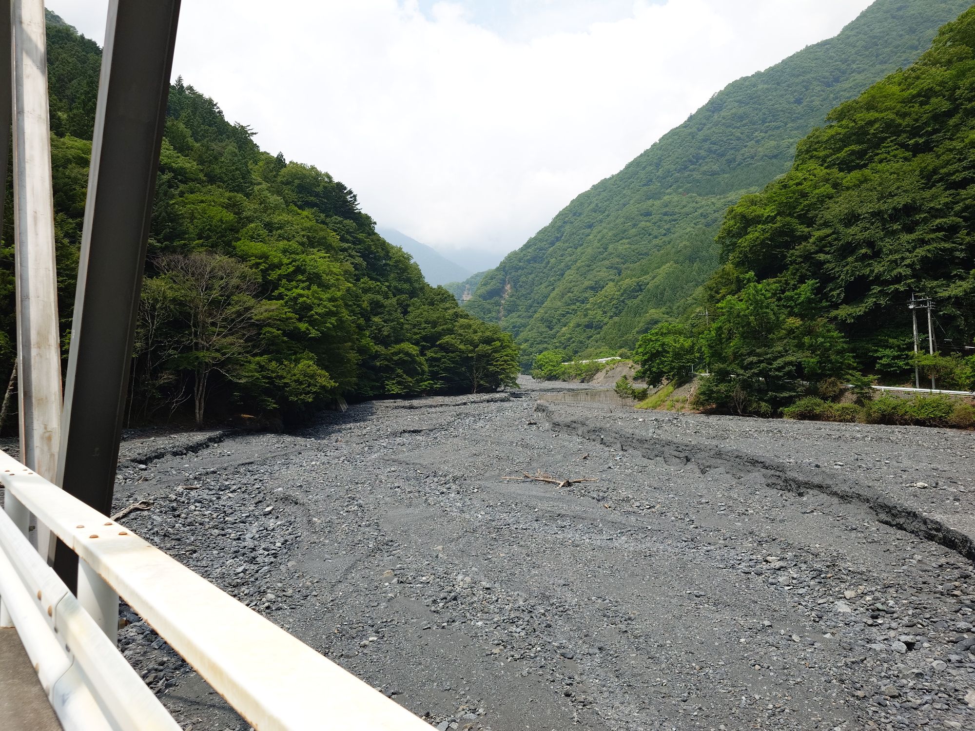
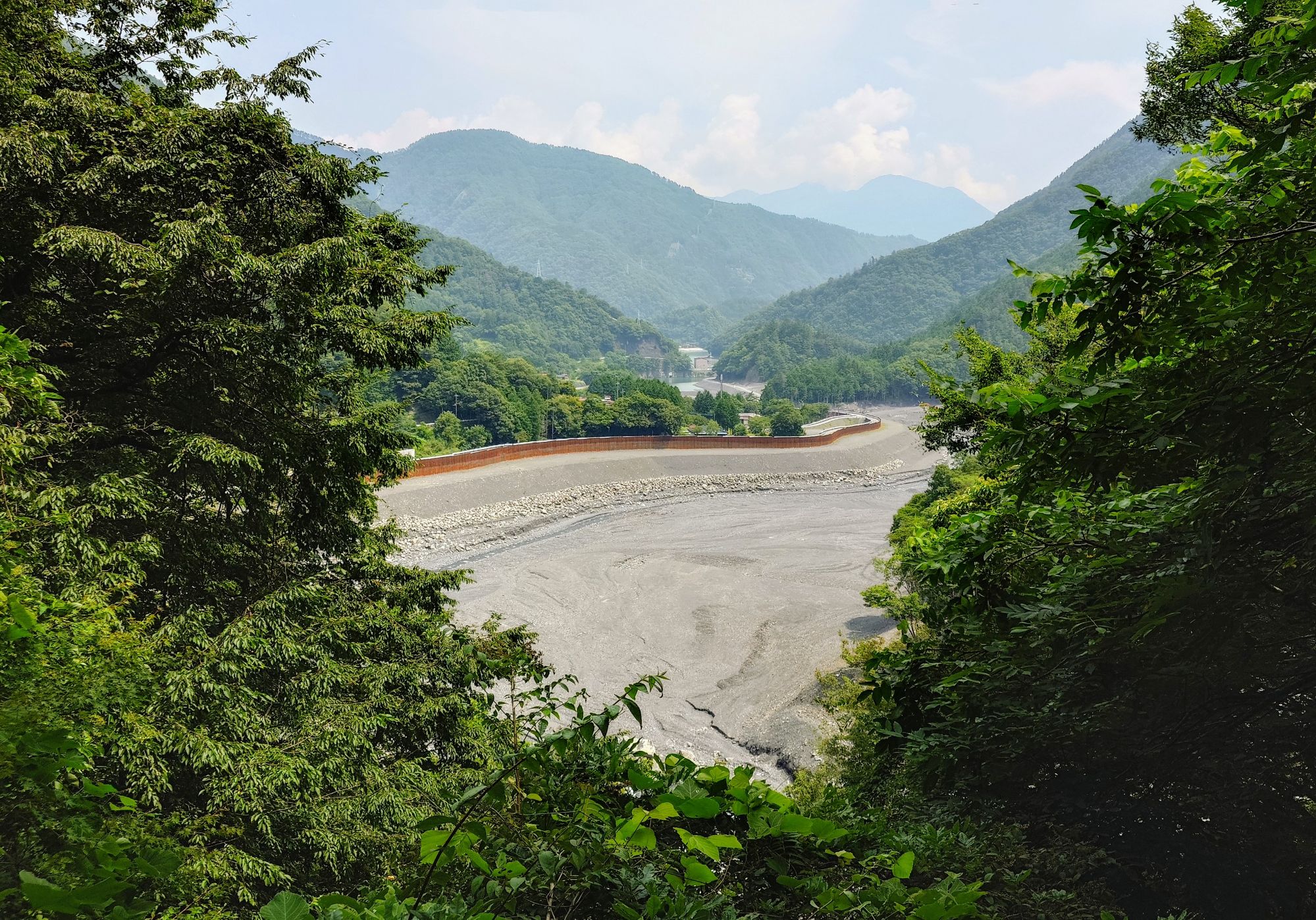
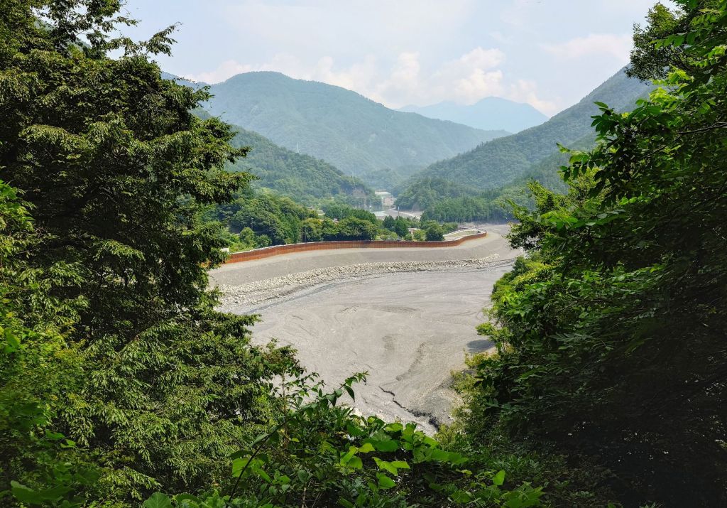
This riverbed is not really what I was after but is common on the Amehata River.
Way up on Yamabushi Pass, where this river draws from, I’d once been lucky enough to witness clouds being formed, pinched and twisted at the convergence of the three valleys at the touge. It was remarkable and one of the saving graces of this road and why everyone ought to try it at least once.
It’s also famous for unique alpine flowers, butterflies that hatch here and float east over Nagano to Fukushima and I’ve seen a serrow or two almost every time I’ve made the effort to get there.
Did I mention it peaks out around 1850 metres too? In summer, you know it’s gonna be cool and just what a Mountain Day run deserves, no?
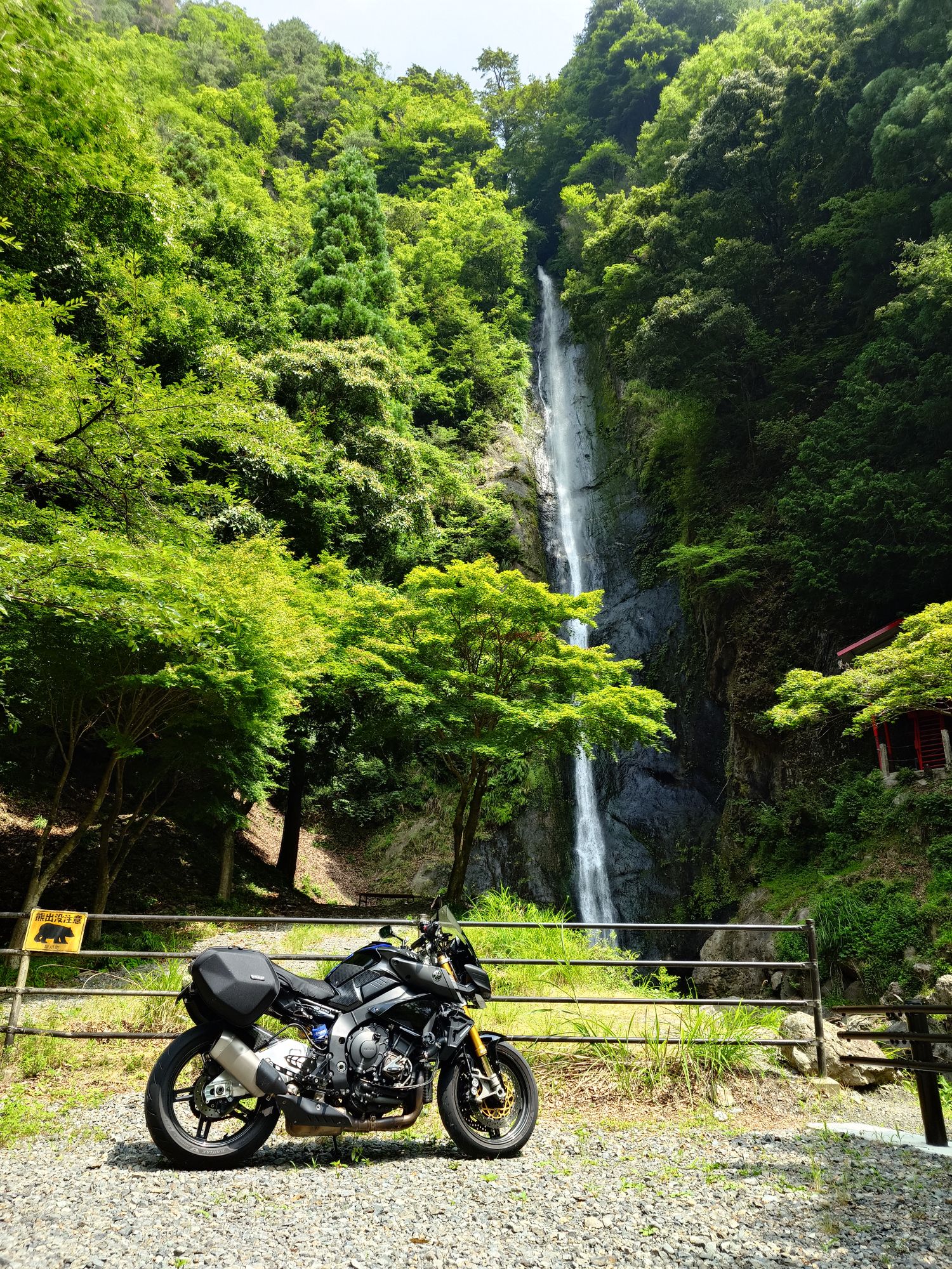
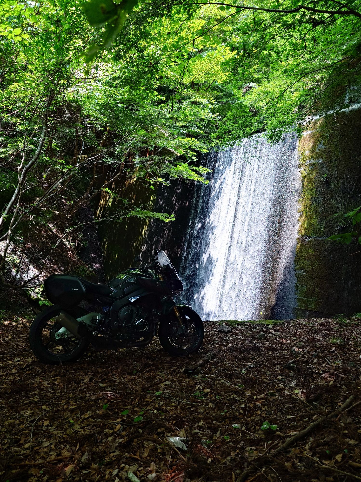
Back on the Amehata Oshima Sen and I couldn’t miss Kenshinnotake. Just look at the height of it!
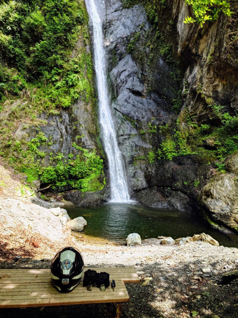
The little stone crusted carpark was a frying pan but up here at the plunge pool with mist softly falling, it had to be 5° cooler and so tranquil.
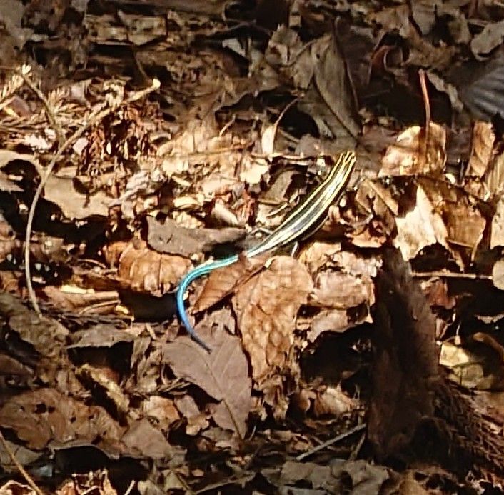
This little critter scampered out, flashed his blue tail about and with that I knew what I had to do.
Aaahhh-
Much cooler, feet chilled and shrivelled like prunes, the road was calling. I could’ve stayed there all day but….
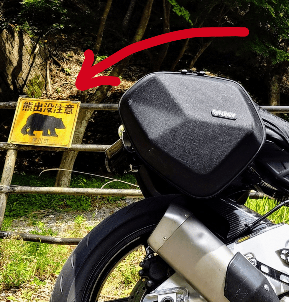
Who wants to be a bear biscuit anyway.
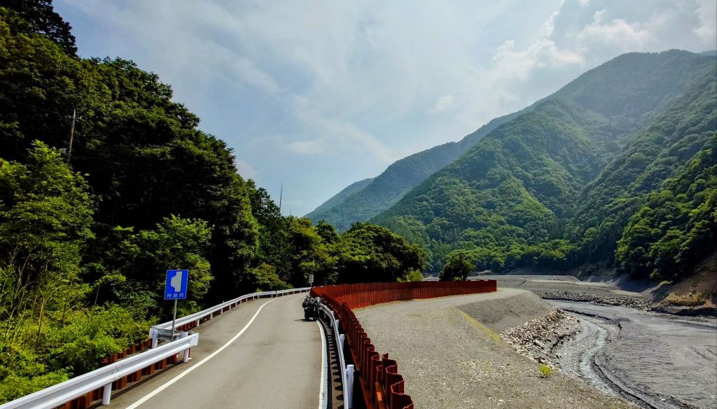
Now that’s a wall! Rusting thick gauge steel to fend off the fury of Amehata’s mountain valley fueled raging floods… with a twisty on top of course.
Another waterfall tucked away off the road. This one has a platform walled off on three sides and made for a good guerrilla camp once.
Alas, Yanbushi was also not to be and this scout run did its job.
It wasn’t a total loss as it’s an opportunity to learn. Initially thinking that this area was just harsh due to nature, some research turned up that man has played its destructive hand here too.
The Amehata River, Amehata meaning ‘rain field’, hosts a dam. A private dam for a mining and aluminium producing company. All the construction and signs of mining, both from the riverbanks and mountainsides, should have been a big enough hint. Not seeing any fisherman or birds on the vast lake and flowing streams should have done so, too. Guess I got lost in the twisties and waterfalls.
Apparently, the chemicals used by the aluminium producing company have leached into the river. The Amehata River flows into the Fujikawa River and down into Suruga Bay. It is said that Aiyu, sweet fish, have disappeared from the Fujikawa downriver of where the Amehata tributary flows in. Similarly, kayakers complain of skin problems after kayaking in this part of the river.
On a somewhat positive note, stocks of sakurebi, small cherry-flower pink shrimp, in Suruga Bay also plummeted but have recently shown signs of recovery.
It’s easy to ride on in ignorant wonder, lapping up the scenic and dramatic environment while rounding rubber though. 🎶 The hills are alive with sound of Yammy crossplane…🎶
Also, that roadblock had me wondering where to head next when my tummy chimed in. ‘Hey up there! It’s lunchtime down here.’
So off we trundled, and I knew just the place and a great road to get there, if it was open.
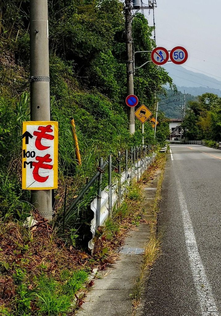
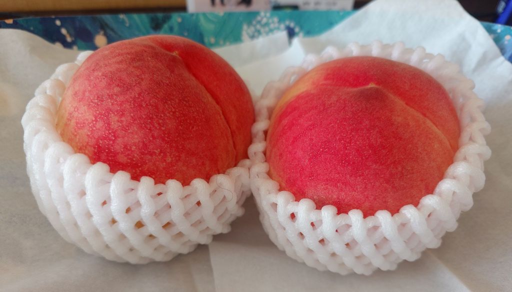
With peach signs everywhere, who could resist a stop n snack. They were so good, two came home in a pannier.
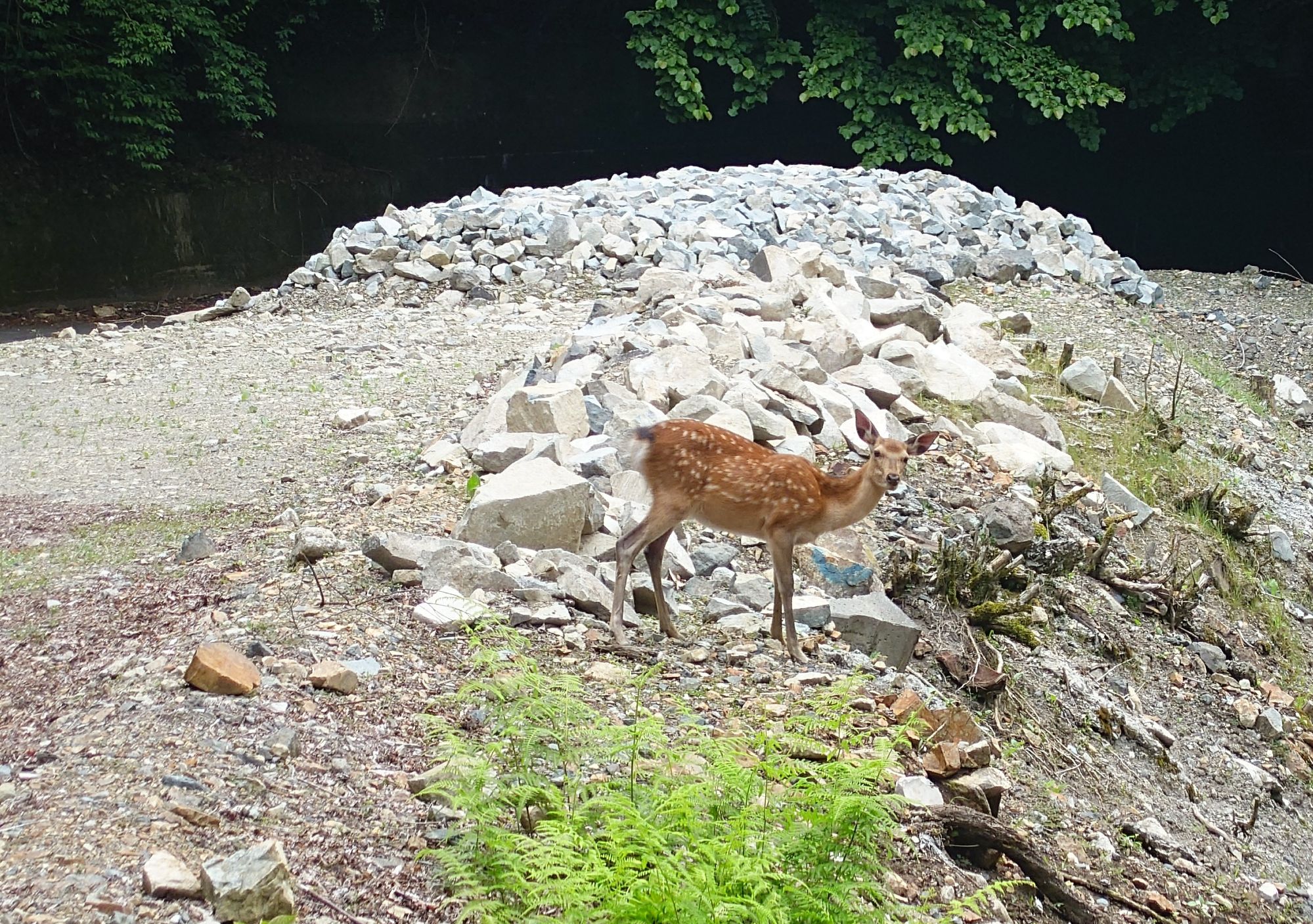
I think my perception of deer being a nemesis is fading. I’m no longer panicking around them, nor paranoid about likely deer infested areas.
I’ve met a few since last year’s unfortunateness and this one was the best. The previous one, 2100 metres up Mt Fuji was a clear, ‘I see you, do you see me? I’m chill. How about you?’ type of encounter. Twice with the same pair on the ascent and descent.
This one was feeding on shoots by the roadside. It knew I was there but wasn’t skittish or perturbed by my stopping and approaching. I walked to within ten metres or so and had a rather one-sided but relieving chat with my new long legged tail twitching road friend. For its part, it just kept munching away and perked up with an occasional acknowledgingly deep stare.
The road was open, the tunnel at the top was a chilly funnel of condensation drenched innards that looked slicker than a rockabillies Regent. It demanded caution but while standing tall on the pegs, the slowdown was mainly to prolong the chill tunnel air flowing through the mesh. Aaahhh! You know the feeling.
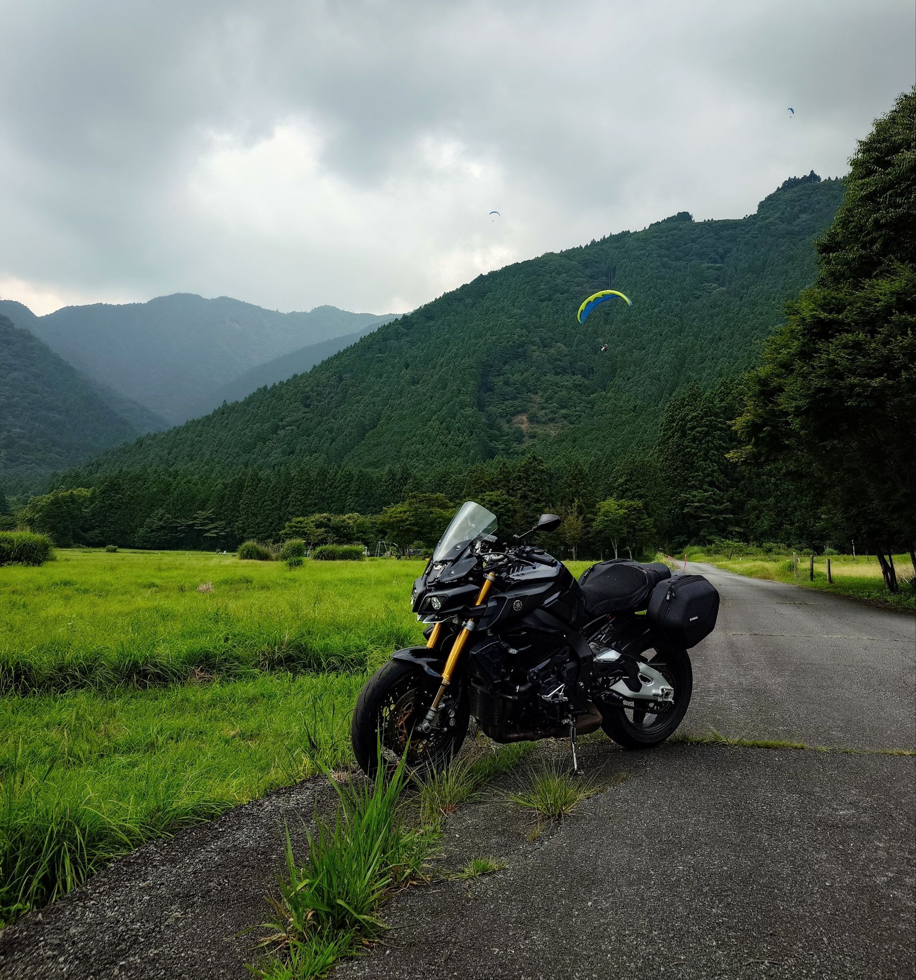
Snaking down from the tunnel at 1250 metres alongside pirouetting paragliders and hangliders to their landing zone 600m below is always fun.
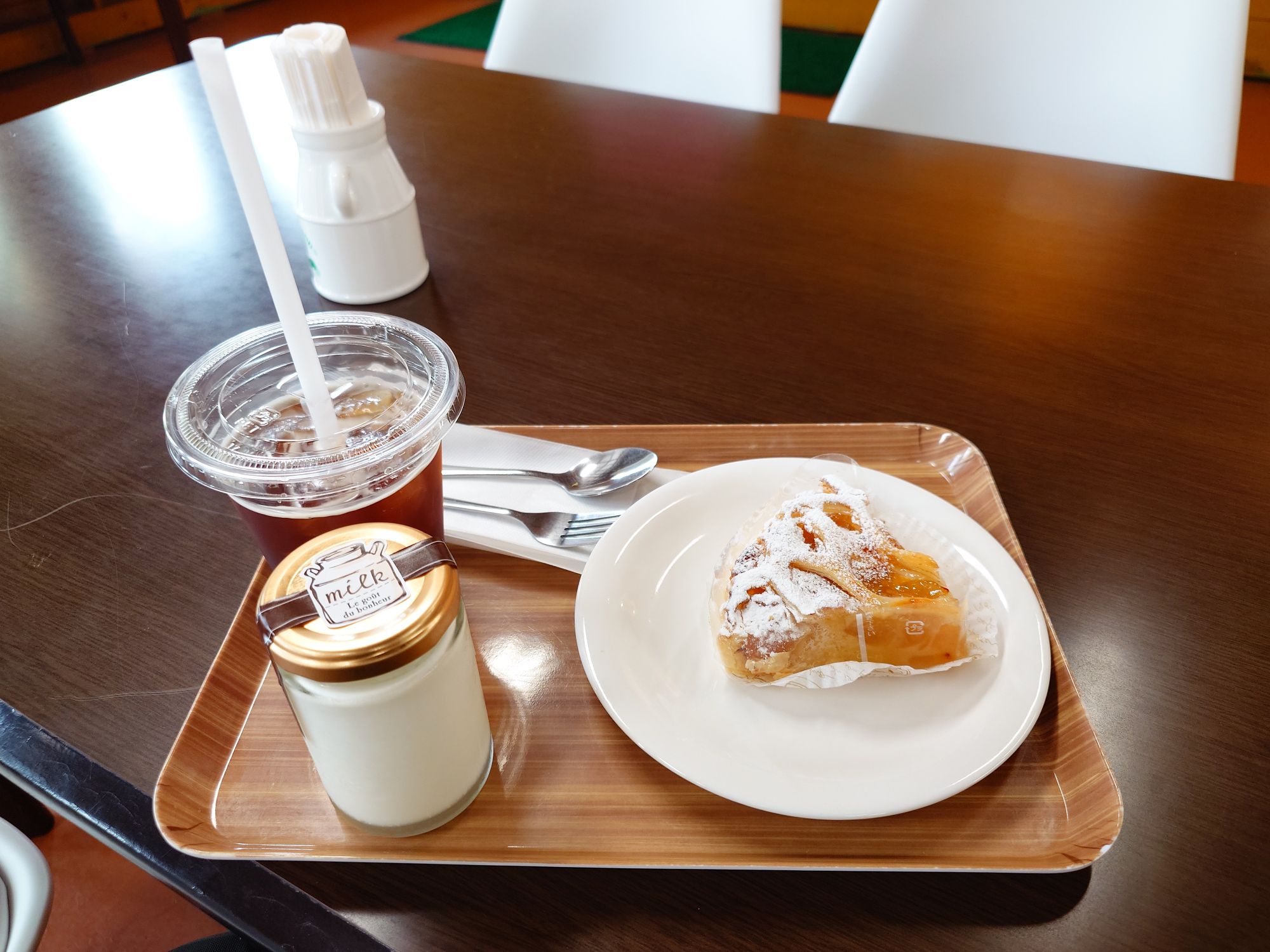
The tummy took control at lunch so no pics of the tacos or epic sausage at the cow farm. This apple pie is definitely going to have me veering off course for a pitstop there again though. 😋
It was a bit toasty there and rather than head around to the southern Shizuoka flank of the Minami Alps and more baking, I decided it was time to head home and a good excuse to ascend the Fuji Skyline for the final chill of the day, or so I thought.
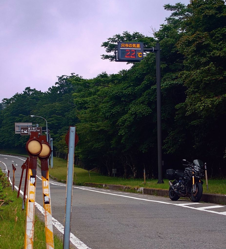
Bottom of the Fuji Skyline had a similar sign showing 30°C. This was much more comfortable.
After loitering about on the Fuji Skyline, enjoying not being hot, the Evergreen Line down to the intersection by the Safari Park and then the deer incident road down to Susono made a lot of sense.
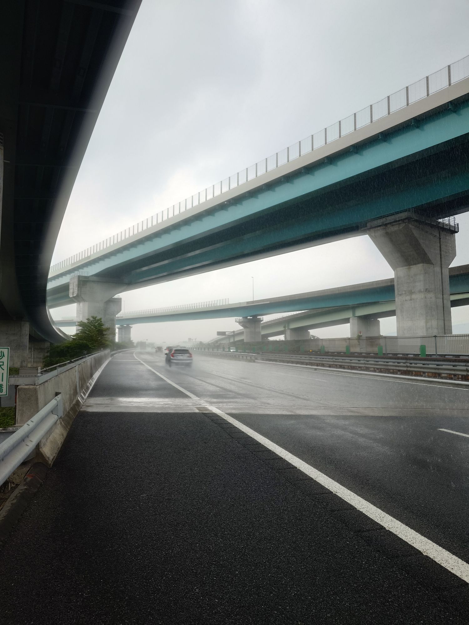
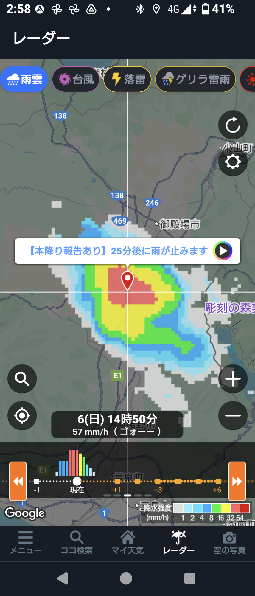
Dry all day then the ETC gate failed at Susono and farted around with that for ten minutes then not two minutes on the expressway and this cell found me and absolutely dumped.
Moral of the story, don’t go home early. Ride all day and some night!
Getting mildly soaked has its benefits when you have 50+kms of hot expressway riding to do, though. Was actually a bit too cold there for a while, especially on the forearms and love handles. Thankfully, I had a fuel issue to take my mind off it.
Distracted by the rain, the flashing reserve went unnoticed until just as I was passing Ashigara PA. Rough calculations had Ebina SA, the next gas stand, around forty kilometres away with 18kms already into reserve. I like to play it safe and max reserve out at forty kilometres but have done sixty five point something on cruise control on the highway before, and it was almost all downhill to Ebina. 🤞
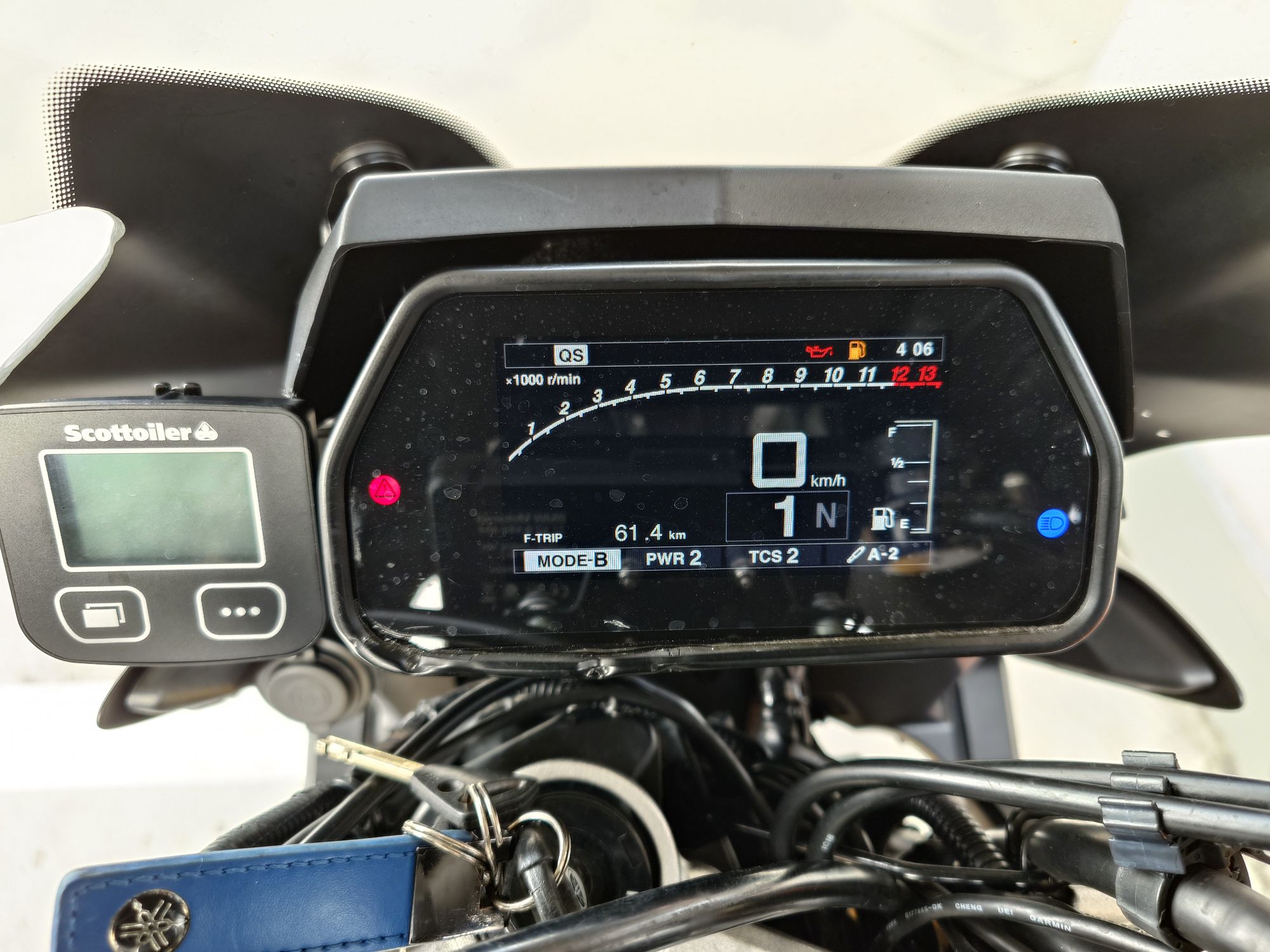
Made it and the 17 litre tank only took 16.4 litres. Likely could have made it to cheaper fuel off the expressway. Btw, paid 172yen/L at my local gas stand in the morning and the expressway pirates took me for 206!
There you have it. The yellow crosses denote the road closures. So, those two ideas swimming around in my head are no more.
Time to chase some other roads on the Mountain Day Twistybutt route next week. Stay tuned.
Now to enjoy those peaches…